
▶ Watch Video: What’s next for those aboard hantavirus cruise ship?
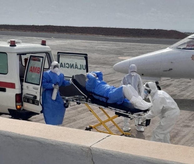
Three patients suspected of having the hantavirus were evacuated from the MV Hondius cruise ship Wednesday and were receiving medical care in the Netherlands, the World Health Organization and the cruise operator said. The three are German, Dutch and British nationals, including a British crew member, according to the WHO.
The rare outbreak of the virus has killed three people from the cruise.
The cruise operator, Oceanwide Expeditions, said in a statement on Thursday that two medical aircraft had landed in the Netherlands carrying the individuals evacuated from the ship the previous day, and that “all three individuals, two symptomatic and one asymptomatic, are now in the care of medical professionals.”
The U.K. Health Security Agency confirmed in a statement Wednesday that one British national had been evacuated from the cruise ship to receive care in the Netherlands. The UKHSA also said it’s aware of two other people who were aboard the MV Hondius who had since independently returned to the U.K. Neither is currently reporting symptoms, and they’ve been advised to self-isolate, the agency said in its statement, adding: “The risk to the general public remains very low.”
The Spanish government reaffirmed Wednesday that the vessel would dock in the Canary Islands, despite local officials contesting the plan.
“I will not make any decision without a mandatory report from the Port Health Authority and the Maritime Authority,” Pedro Suarez, the head of the port authority in Tenerife, in Spain’s Canary Islands, told Radio Canaria on Thursday. “The final decision is mine.”
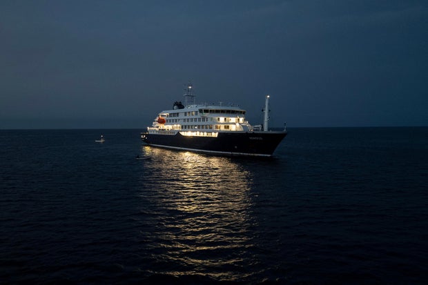
Oceanwide said in its statement Thursday that it was continuing “to monitor the progress of m/v Hondius, which departed Cape Verde at 19:15 CET yesterday (6 May) and is sailing for the Canary Islands, specifically the port of Granadilla (Tenerife). This is expected to take 3-4 days.”
It said there were no symptomatic individuals on board the vessel and that it was “in close and continual discussion with relevant authorities regarding our exact point of arrival, quarantine and screening procedures for all guests, and a precise timeline.”
The plan announced Tuesday, coordinated between the Spanish government and the WHO, had been for the ship to head to the Canary Islands for a “full investigation” and “full inspection” after the three patients were evacuated. But the leader of the archipelago’s regional government, Fernando Clavijo, rejected the idea Wednesday morning, saying he had requested a meeting with Spain’s socialist Prime Minister Pedro Sanchez.
In a social media post, Clavijo, a member of Spain’s conservative political opposition, wrote: “The Canary Islands always acts with responsibility, but it cannot accept decisions taken behind the backs of the Canary Islands institutions and without sufficient information to the population.”
AFP via Getty Images
At a later news conference, however, Spain’s health minister Monica Garcia Gomez doubled down on the plan, saying the ship would dock in Tenerife, “within three days.”
“A joint system for health assessment and evacuation will be put in place to repatriate all passengers, unless their medical condition prevents it,” she told reporters.
Tedros Adhanom Ghebreyesus via X/ Reuters
Dr. Jay Bhattacharya, acting director for the U.S. Centers for Disease Control and Prevention, said in a statement Wednesday night that the CDC has been “coordinating with domestic and international partners” since it learned of the outbreak.
The CDC was “preparing medical support” for all Americans aboard the cruise ship, Bhattacharya disclosed. Oceanwide Expeditions has said there are 17 American passengers still aboard the Hondius.
Two Georgia residents who were passengers on the Hondius, but have since returned to Georgia, are being monitored but have shown no signs so far of infection, the Georgia Department of Health reported Wednesday.
“The safety and health of the affected American travelers is our number one goal,” Bhattacharya said.
South African authorities confirmed on Wednesday that they had identified the so-called Andes strain of the hantavirus in two people who had previously been on the cruise. The Andes strain, which is found primarily in Argentina and Chile, can be transmitted from human to human, unlike other strains of the virus.
Swiss authorities announced Wednesday that a man who previously traveled on the ship and returned home at the end of April had also tested positive for the Andes strain of the virus, adding that there was “currently no risk to the Swiss public.”
The French Ministry of Health, meanwhile, told the country’s BFM TV network a French “contact case” had been confirmed. The man is believed to have traveled on the same flight as one of the two patients evacuated to Johannesburg for treatment in late April.
There is currently one British national in intensive care in South Africa after being on the cruise, but the French authorities were likely referring to the other patient evacuated to Johannesburg, a 69-year-old Dutch woman who the WHO said got off the ship with “gastrointestinal symptoms” on April 24 and died two days later after her condition “deteriorated during a flight to Johannesburg.”
That brings the total number of suspected or confirmed cases to nine, including three who have died, five confirmed as receiving treatment and the French man, about whom few details have been given.
Oceanwide Expeditions said two infectious disease specialists were heading Wednesday from the Netherlands to the cruise and would “remain with the vessel after its anticipated departure from Cape Verde.”
Danilson Sequeira / REUTERS
The Dutch-flagged MV Hontius, a luxury cruise liner, left Ushuaia, Argentina, on April 1. It has been anchored off Cape Verde, an island off Africa’s west coast in the Atlantic, since Sunday.
Argentina’s health ministry said in a statement Wednesday that it was reconstructing the itinerary of the Dutch couple, who had traveled through southern Argentina and Chile before the expedition. It will also conduct rodent capture and analysis in Ushuaia, the statement said.
So far, no cases associated with the outbreak had been identified in Argentina, the health ministry said.
Ann Lindstrand, the WHO representative in Cape Verde, told CBS News’ Ramy Inocencio on Tuesday that there was no risk of a pandemic-level threat with the hantavirus given the low likelihood of human-to-human transmission.
Bhattacharya echoed that guidance Wednesday, saying that hantavirus “is not spread by people without symptoms, transmission requires close contact, and the risk to the American public is very low.”
Lindstrand said she was in contact with a volunteer doctor on the boat who told her the passengers were “coping surprisingly well,” though they were anxious to know what their next port of call would be.
“We have heard from quite a few people on the boat,” Maria Van Kerkhove, WHO director of epidemic and pandemic preparedness and prevention, said Tuesday. “We just want you to know we are working with the ship’s operators. We are working with the countries where you are from. We hear you. We know that you are scared.”