▶ Watch Video: Heavy smoke from Canadian wildfires impacts air quality from Minnesota to New York
The United States is burning faster than usual this year, while massive smoke plumes from Canadian wildfires deplete air quality on both sides of the border. Experts believe the severity of the current fire season, affecting millions of acres of land between both countries, was primed by climate extremes.
More than 100 wildfires raged in Canada on Thursday and strong winds were carrying their smoke — plus more from a few large fires in Minnesota — across the Upper Midwest and northeastern U.S., exposing millions to harmful pollution.
Around 3,500 Canadian fires have enveloped about 2.3 million acres of land this year, a startling statistic that’s more or less on par with the country’a 10-year average number of acres burned by mid-July. It’s actually lower than Canada’s 5-year average, which is twice as high after recent extreme fire seasons.
Fire seasons, in Canada, the U.S. and elsewhere across the world, are starting earlier and lasting longer. They’re also “harder to contain,” smoldering through the winter as “zombie fires,” according to the Canadian Climate Institute, which has noted how climate change worsens wildfire threats and, in some instances, may multiply “the likelihood of extreme fire weather” several times over.
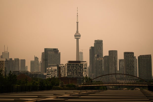
Laura Proctor/The Canadian Press via AP
In the U.S., close to 40,000 fires have torn through more than 3.6 million acres so far in 2026, including half a million acres in the last two weeks alone, according to the U.S. National Interagency Fire Center. That’s almost 10,000 more fires, and almost a million more acres burned, than the 10-year average for mid-July. In a new advisory, the center said “fire activity is already mirroring conditions normally not seen until later in the season.”
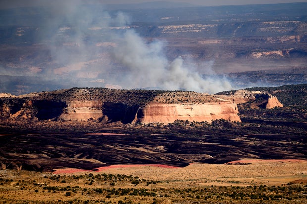
Blazes have scorched hundreds of thousands of acres since January in the American West, with Colorado and Utah hit hardest. At the end of June, three firefighters died and two were injured in the Knowles Fire along the states’ shared border.
Of the 48 large wildfires still active nationwide, 10 are in Colorado or Utah. Most others are scattered across Arizona, California, Idaho, Nevada, New Mexico, Oregon and Washington state.
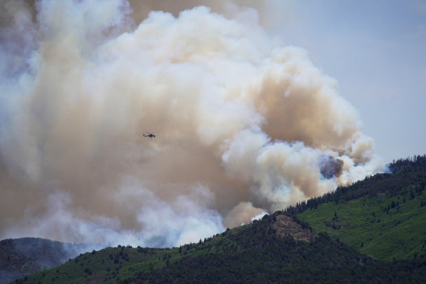
AP Photo/Ty ONeil
“From a landscape point of view, from a fuels point of view, and from a weather and climate point of view, everything has kind of converged,” Jon Meyer, Utah’s assistant state climatologist, told CBS News.
Prolonged drought, record heat and historically low snowpack in western states have created “the perfect storm of conditions,” as Meyer put it, for one of the region’s worst wildfire seasons in a decade.
Nick Nausler, of the National Weather Service’s Storm Prediction Center, said the intensity is not entirely surprising “given the conditions” that preceded it.
Compounding a snow drought that raised alarms this spring as snow cover dwindled over the Rockies and Cascades, western states also faced repeated heat waves that began in March and persist into the present.
Dan McEvoy, a researcher at the Nevada-based Western Regional Climate Center, said the 2026 snowpack in Colorado and Utah was “the worst ever seen in some cases” going back 50 to 75 years.
Snowpack across the northern band of Canada has also decreased — a decadeslong downturn, according to the Canadian government.
An integral part of regional water systems in the U.S. and Canada, the runoff from snowpack brings moisture to downstream soil as it melts. Without enough of it, land and vegetation become increasingly susceptible to ignition. McEvoy said that this year, high temperatures triggered premature snowmelt that gave the terrain an extra month to dry out before fire season even began.
Climate change
Canadian officials openly blame human-caused climate change for the shifting warmth, snowpack and drought patterns that underpin its shifting wildfire seasons. U.S. experts told CBS News that while climate change doesn’t necessarily tell the entire story of any single fire season — factors like forest management also play a role — its fingerprints on this one have been difficult to miss.
Noah Diffenbaugh, a Stanford University climate scientist, cited research that attributes roughly half of the long-term increase in the area burned across the western U.S. to climate change, meaning that without it, the total acreage burned would be about 50% of what it’s been.
Higher temperatures influence wildfire patterns “both via snowpack and atmospheric demand,” Diffenbaugh said, “and these are all trending in a way that increases wildfire risk in the West.” At this point, even the most ambitious targets for reducing carbon emissions likely won’t be enough to prevent those trends from continuing, he added.
AP Photo/Noah Berger
A number of western U.S. states just experienced their warmest winters on record, helping drive this year’s snow drought, McEvoy said. And Meyer described broader consequences of climate change, like fiercer heat and longer stretches of it, as “loading the dice” for harsher fires in any given year.
Tim Brown, another climate researcher and McEvoy’s colleague, also noted how the West is experiencing “hotter droughts” than it once did due to the warmer temperatures, which is another factor fueling its wildfires. Brown said a fire season can’t be reduced to climate change alone, telling CBS News that “climate is enabling fire, and weather is driving fire.”
What forecasters are watching next
The National Interagency Fire Center’s most recent seasonal outlook keeps most of the West at above-normal risk of wildfires into the fall. Although confidence in the forecast beyond August is lower because of a strengthening El Niño, some signals point to a possible monsoon offering relief to a handful of states.
McEvoy said the pattern is likely to shift north as summer wears on, with above-average wildfire potential expected in August and September for Northern California, Oregon, Washington and the Northern Rockies.
Diffenbaugh warned that the West is still early in its fire-risk calendar. The Diablo and Santa Ana winds that drive many of the region’s most dangerous autumn fires haven’t arrived.
“There’s still months to go,” he said.